This post is also available in:
 עברית (Hebrew)
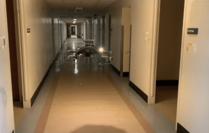
Search and rescue missions are both tremendously important and incredibly dangerous. A team of Researchers at Carnegie Mellon University’s Robotics Institute (RI) set out to reduce this risk by creating a network of autonomous aerial robots that can explore the inside of buildings, possibly safeguarding first responders after disasters by shortening the time spent looking for survivors.
The operation is designed to involve multiple aerial robots at once to maximize efficiency – each robot exploring a different set of rooms. For this reason, coordination and communication among robots were key components the team focused on, according to their press release. The drones are programmed to quickly identify doors and enter rooms, taking into account the fact that people are more likely to be in rooms than in hallways. In order to do so, the drones are equipped with a LIDAR sensor that can analyze the geometric properties of the environment, according to Interesting Engineering. The 3D LIDAR point cloud data is then converted into a simpler 2D map, which represents the layout of the space. The Drones use this 2D map to identify key structural features such as doors and rooms, making it easier for them to navigate and understand the environment. Walls are represented as occupied pixels on the map, while an open door or passageway appears as empty pixels, allowing the drones to identify passageways and quickly navigate through them. When a drone enters a room, its placement shows up as a circle on the map.
The reason LIDAR technology was favored over traditional cameras is twofold: first, LIDAR sensors demand less processing power than a camera. Second, LIDAR sensors operate better than a camera in an environment where vision is obscured, a common attribute of disaster scenes, which are many times filled with dust or smoke.
In order to maximize efficiency, the robots communicate with each other and share the list of doors and rooms they have examined. Using this information, the drones avoid places that have already been checked and calculate the best path they can use.
Currently, this method is limited to single-story buildings, with the aim to extend it to multi-level buildings in the future.
The research was published in the journal IEEE Robotics and Automation Letters.


