Rising Concerns Over Security Risks of China-Made LiDAR Sensors
Security concerns are growing in the United States regarding the use of LiDAR (Light Detection and Ranging) sensors made in China, with experts warning...
Watch: Advanced “Robo-Wolves” Could Replace Soldiers in Battle
At this year’s Airshow China in Zhuhai, China South Industries Group Corporation (CSGC) unveiled its latest development in unmanned combat technology: a series of...
Greyshark: A Revolutionary Autonomous Underwater Vehicle for Surveillance and Reconnaissance
German firm Euroatlas has revealed its latest innovation in underwater surveillance technology: the Greyshark, an autonomous underwater vehicle (AUV) designed for long-distance reconnaissance, patrol,...
Robot Dog that Works Underwater Could Help in Rescue Missions
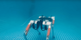
Polish robotics firm MAB Robotics has showcased its flagship quadruped robot, the Honey Badger, demonstrating its impressive amphibious capabilities in recent footage. The robot,...
Innovative Thermal Imaging Camera Enhances Road Safety
As autonomous vehicles continue to evolve, ensuring their safety in low-visibility conditions has become increasingly critical. A team from Fraunhofer IOF is addressing this...
Call for Technologies: Defense Industry Seeks AI Solutions
iHLS, in collaboration with a large defense industry is looking for companies with proven capabilities in several areas to participate in a demonstration of...
These Drones Can Navigate Collapsed Building and Assist First-Responders
Search and rescue missions are both tremendously important and incredibly dangerous. A team of Researchers at Carnegie Mellon University’s Robotics Institute (RI) set out...
Innovative Navigation Tech Lets Drones “Fly Blind”
Canadian company developed a system it claims will turn “dumb drones” smart with a “world-first in navigation technology” and enable highly accurate navigation even...
Self-Driving Cars Get Enhanced Object-Tracking Abilities
Researchers at the University of Toronto Institute for Aerospace Studies (UTIAS) introduced new high-tech tools that improve the safety and reliability of autonomous vehicles...
Germany’s New Heron TP UAV Uses Many Israeli-Made Systems
Germany, who is reconsidering its defense needs seeing the ongoing war between Ukraine and Russia, has signed a “pivotal agreement” with Israel Aerospace Industries...
New Stealth Camera Tech Replaces LiDAR to Tackle Laser Detection
Researchers from the Southwest Research Institute in Texas developed camera-based autonomous driving tools that can work without using technologies like LIDAR and RADAR, an...
World’s 10 Most Advanced Military Robots
Armies worldwide use various automated machines for military purposes, combat, cargo, intelligence gathering, and much more. The following are 10 of the world’s most...
Airbus Tests Tablet-Driven Autonomous Helicopter
Aircraft manufacturer Airbus achieves a breakthrough with its Vertex project- a tablet-controlled autonomous helicopter that streamlines missions, reduces pilot workload, and enhances safety in...
Machine Learning Revolutionizes Navy Helicopters Landing on Ships
One of the most difficult tasks for Navy pilots is landing a helicopter on a ship. Those involved have to be incredibly coordinated and...
What Do We Know About Artificial Navigation?
Developing artificial intelligence and autonomy in the realm of self-driving cars has been easier in the commercial world where a large amount of data...
How Can Pilots Fly In Harsh Environment? This Is One of...
Often, military forces have to fly in challenging operating environments. In the Middle East, pilots would often experience a “brown out,” which occurs when...
LiDAR And Deep Learning – A Recommended Combination
A new LiDAR perception system delivers highly accurate object detection, tracking, and classification, bringing the enhanced capabilities that enable autonomous vehicles to new industries. Endeavor...
Better Smaller Cheaper LiDAR Possible with New Development
Researchers have found a way to improve LiDAR systems with a new chip-based beam steering technology. This new development promises a smaller system that...
Robot Dogs – The Four-Legged Future of Technology?
We are all familiar with the global race for autonomous deliveries, led mainly by developments of aerial and wheeled vehicles, but other solutions might...
How Can Robots And Cars See Better?
Though robots don't have eyes or retinas, the technology commonly used by ophthalmologists can give them the means to see and communicate with the...
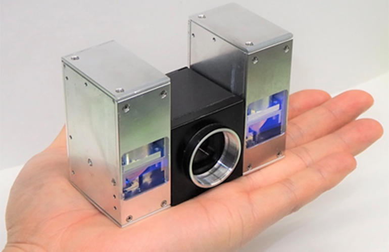
Tech Giant Unveils New Palm-Sized LiDAR
A much smaller version of the current LiDAR system is being developed by the Japanese tech giant since it released its latest launch in...
Innovative Mapping Solution for Underground Environments
Data capture experts have been using Hovermap payload to map challenging and dangerous environments, from the world’s deepest base-metal mine to oil and gas...


