- home
- News
- Technology
- Cyber
- HLS
- Innovation
- Unmanned
- Video
- Events
- Accelerators
- עברית
- Subscribe
- Contact Us
- home
- News
- Technology
- Cyber
- HLS
- Innovation
- Unmanned
- Video
- Events
- Accelerators
- עברית
- Subscribe
- Contact Us
Emergency Medical Services
Who Profits from Coronavirus? Hint: They’re Not Human
According to various reports, the Chinese government has been using drones, robots, and artificial intelligence technologies in the fight against the coronavirus, and limit...
What is Military Role in Coping with Coronavirus?
Concerns have been rising regarding the spread of the Coronavirus outside the boundaries of China, and the World Health Organization has already defined the...
This Technology is Upgrading First Responders Capabilities
Law enforcement and first responders have been using drones for more and more missions.
Incident commanders receive critical visual information and situational awareness through the...
Emergency Communications Trends for 2020
Organizations for public safety, including firefighters, law enforcement, among others, are responsible for protecting people in emergencies. These first responders can work effectively only...
Everything Connected – Public Safety Tech Forecast for 2020
The global public safety market was valued at USD 8.58 billion in 2018, and it is expected to reach USD 38.98 billion by 2024,...
Turning Point in Medical Care on Battlefield
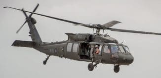
Medical care on the battlefield is taking a new turn. The US Army is looking to autonomous vehicles, including unmanned air vehicles (UAVs), to...
Video Sources Fusion Helps Emergency Responders
First responders often lack information when dealing with emergencies. Despite the thousands of cameras we see on the street, in businesses, at the bank,...
First Open-Ocean Flight by Hydro-Powered Drone
An open-ocean drone test flight driven by the goal of improving timely delivery medical services was completed between two islands in under two hours....
Drone’s Advantage in Life-Saving Missions
Each year in the U.S., more than 350,000 people outside of hospitals have a cardiac arrest, when the heart stops beating because its electrical...
Doubling Medevac Capacity
Aerial systems can perform large scale evacuation in cases where rescuing many patients and survivors and swiftly bringing them to medical installations is required....
Smart City Mobile Solution
A provider of physical security intelligence and access control technology has recently announced the debut of its command and control center that helps pave...
These Sensors will Help First Responder Teams
Early warning of floods can supply first responders with the critical time needed for the mitigation of the disaster. The US Department of Homeland...
How to Manage Effective Emergency Response?
At times of disaster, first responder agencies have to operate in effective coordination and maintain communication channels in order to cope with the complex...
Interactive Map Shows Where Disasters Are Happening
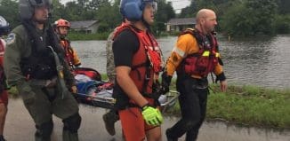
Recently, the Hillsborough River in Florida was flowing at more than 3,020 cubic feet per second, with the river’s surface being at 31.48 feet...
Israeli Technology – Firefighting and Rescue Teams Spearhead
Fires constitute one of the most extreme dangers to human lives and property. When every second counts, the response is conditioned on mobility and...
Egozi: Home Front Command Confirms iHLS Claims that Home Front Not Prepared
By Arie Egozi
During the last several years, I have been claiming here that the Israeli home front was not prepared for emergency situations vis...
Collaborative Platform to Help Keep Schools Safe
School safety is extremely imperative nowadays, considering the amount of school shootings that have occurred in the United States, killing and ruining many young...
Ground-Breaking Israeli Development Wins World Innovation Prize
ESRI is the Microsoft of the geographic information realm. The company supplies the GIS mapping platform - a pivotal tool for building geographical command...
Dual-Use Indoor Location Platform
Locating employees quickly in vast workplaces such as hotels is key to preventing or minimizing incidents. Locating 911 callers ensures that they get help...
911 Caller Location Detection in Multi-Story Buildings
Emergency call centers sometimes find it hard to accurately locate an address when a person uses a cellphone to dial 911. For years, the...
Latest
Copyright © 2012 i-HLS. All Rights Reserved.


