This post is also available in:
 עברית (Hebrew)
Inspecting pipelines, power lines and transportation corridors presents a difficult logistical problem. These assets can stretch for hundreds of kilometers through remote terrain, making ground inspections slow and expensive. Small commercial drones can cover portions of these networks, but their limited endurance, payload capacity and communications range make them less practical for continuous monitoring across large areas.
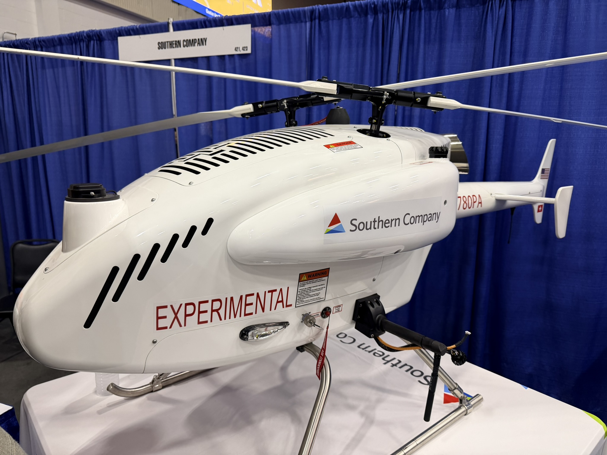
A long-range uncrewed inspection platform developed around the SwissDrones SDO 50 aims to provide an alternative. SwissDrones and Xplorate Pacific are expanding the system into the United States, targeting energy, utility and transportation operators that require aerial intelligence across geographically dispersed infrastructure.
Unlike a conventional battery-powered quadcopter, the platform is a turbine-powered uncrewed helicopter designed for longer-duration missions and heavier sensor payloads. The aircraft can carry equipment including LiDAR, RGB cameras and multispectral sensors, enabling operators to collect different types of information during the same mission. Other potential configurations include sensors for detecting methane emissions around energy infrastructure.
The platform is intended for beyond-visual-line-of-sight (BVLOS) operations, meaning the aircraft can continue flying after it leaves the direct sight of its operator. This capability is particularly important for inspecting linear infrastructure, where requiring a pilot to remain physically close to the drone would significantly limit its usefulness.
According to Interesting Engineering, the system goes beyond collecting aerial images. Sensor information can be georeferenced and processed into data that engineering, maintenance, environmental and compliance teams can use to evaluate infrastructure condition, identify damage or monitor emissions. Satellite-enabled command and control can also support operations in remote areas where terrestrial communications are unavailable, subject to regulatory and mission-specific requirements.
The approach is already being used commercially along a 550-kilometer pipeline corridor in Australia. One of the companies also holds authorization covering approximately 58,000 square kilometers, enabling certain day and night BVLOS missions around pipelines, power lines, processing facilities and other remote infrastructure.
The technology also has clear homeland security and defense relevance. Pipelines, electricity networks and transportation routes are critical infrastructure that can be affected by accidents, natural disasters, sabotage or other security threats. Long-endurance uncrewed aircraft equipped with optical, thermal or LiDAR sensors could provide persistent monitoring over vulnerable corridors while reducing the need to deploy personnel or crewed helicopters across large areas.
Deployment in the United States will initially proceed on a program-by-program basis under applicable Federal Aviation Administration approvals. Meanwhile, the drone company is developing the larger SD120, designed to offer increased payload capacity, endurance and redundancy.
As regulators move toward broader BVLOS operations, long-range uncrewed aircraft could increasingly shift infrastructure inspection from periodic site visits toward persistent aerial monitoring, giving operators a faster picture of conditions across assets that may span hundreds of kilometers.