- home
- News
- Technology
- Cyber
- HLS
- Innovation
- Unmanned
- Video
- Events
- Accelerators
- עברית
- Subscribe
- Contact Us
- home
- News
- Technology
- Cyber
- HLS
- Innovation
- Unmanned
- Video
- Events
- Accelerators
- עברית
- Subscribe
- Contact Us
Space
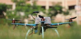
Unmanned Aerial Vehicle to Proivde Satellite Navigation
With unmanned aerial vehicles (UAVs) representing a rapidly expanding user base, a new UAV is joinging the ranks of the Navigation Laboratory of the...
Machine Learning Solution for Prevalent Aviation Challenge
Weather conditions such as fog and low stratus clouds over airports are responsible for severe flight delays translating into heavy costs for airlines. Determining...
Alexa Voice Assistant – to Mission in Space
Unique human-machine interface technologies will be integrated into NASA’s Orion spacecraft thanks to a collaboration between technology giants. Lockheed Martin, Amazon, and Cisco have...
New Unmanned Initiative Designed for Global Communications
The UK government is interested in advancing an unmanned initiative in the stratospheric layer of the earth's atmosphere, extending to about 32 miles (50...
Reverse Engineering UFOs
Most unidentified flying object (UFO) sightings are likely the result of optical illusions or hardware glitches. It’s also likely that at least some of...
Marker UGV – Will it Reach the Moon?
A new Russian unmanned ground vehicle has the potential to be used in research missions on the moon and other celestial bodies.
The Russian military...
Alternative to Satellite Imagery
The use of satellites has long been the preferred choice for gathering geospatial data for agriculture, forestry, infrastructure, and construction projects. But despite the...
Industry and Military Are Joining Forces – In Israel and Globally
The distributed nature of operations military forces will likely be engaged in in the future requires flexible, resilient, and robust communications where units will...
Israeli Technology Enhances World Leading Defense Systems
The development and manufacturing of systems for the defense and aerospace fields pose challenges that require both expertise and creativity to come up with...
New Military Satellite Launched into Orbit
Space is seen more and more as a new military frontier, and rival countries are investing heavy resources in space technology.
Military satellites give the...
Detecting GPS Jammers
The proliferation of electronic devices designed to interfere with Global Positioning System signals is a problem for the Pentagon and for many industries that...
Cloud Computing – Now in Low Earth Orbit
New technology is expected to advance cloud computing capabilities in the low earth orbit (LEO). Objects in low-earth orbit are at an altitude of...
Drone and Satellite Collaboration Has Yielded Unexpected Results
Understanding the severity and distribution of a fire within a forest can assist with estimating and modeling future forest fires. Unmanned aerial vehicle LiDAR...
IAI Unveils Innovation in Satellite and Space Fields
Open innovation methodology to encourage technological diversity and entrepreneurship at Israel Aerospace Industries (IAI). The company has developed an innovative system for operating and...
Satellite Video for UAVs in Critical Missions
Thanks to their ability to take pictures and send video from a privileged position of remote locations, unmanned aerial vehicles are well suited for...
Space-Based ISR for Troops at Battlefield
Access to information will be critical in the future operating environment. A new line of military tactical Intelligence, Surveillance, and Reconnaissance (ISR) satellites will...
New Military Navigation Solutions for GPS-Denied Environments
Position and timing signals from global navigation satellite systems (GNSS) such as GPS, Galileo, GLONASS and Beidou have become the primary source of navigation...
AI in Military Market Demonstrates Unprecedented Growth
Artificial Intelligence (AI) technology in the military market is estimated at $6.3 billion in 2020 and is projected to reach $11.6 billion by 2025,...
New Move to Counter Navigation Systems’ Jamming and Spoofing
Accurate positioning, navigation, and timing (PNT) is necessary for the functioning of many critical infrastructure sectors. Precision timing is particularly important and is primarily...
Automated Target Detection in the Future Battlefield – IAI and Matrix Collaboration
In an age of big data, operational systems’ operators are grappling with information influx. Integrating operational scenarios and automated tools with high reliability will...
World’s Biggest Drone Prepares for Special Mission
Satellite delivery is usually carried out by a ground-based rocket, which is expensive and time-consuming to launch. The new Ravn X drone for autonomous...
Hypersonic Missile Defense Technology Under Development
Many of today's missile-defense systems are not able to track and kill hypersonic weapons, which are designed to outmaneuver contemporary detection systems through speed...
Latest
Copyright © 2012 i-HLS. All Rights Reserved.


