This post is also available in:
 עברית (Hebrew)
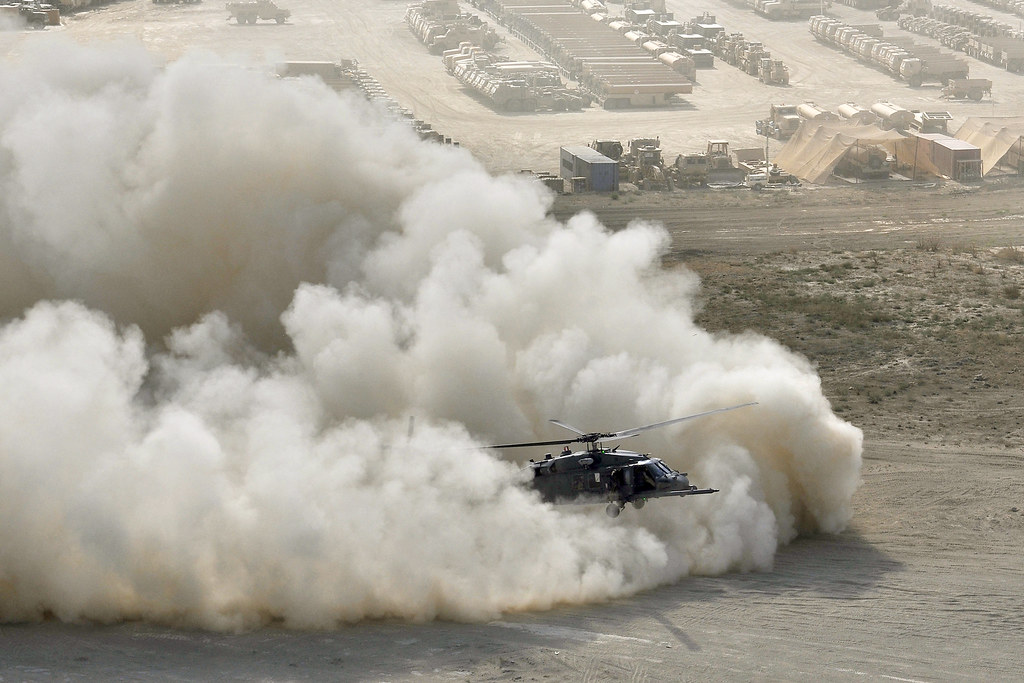
Nearly a quarter of all military aircraft crashes and 44% of aviation fatalities since combat operations began in 2002 in Afghanistan and Iraq were caused by degraded visual environments (DVEs), such as smoke, sand, snow, rain, night and fog conditions, according to statistics from the U.S. Army Combat Readiness Center.
Landing a helicopter in choking dust or blinding snow can be particularly difficult because pilots can become disoriented easily near the ground as they lose view of the horizon and other visual cues. This can cause pilots to roll the aircraft while close to the ground, which risks hitting the rotors on the ground or other nearby objects.
U.S. Air Force helicopter avionics experts needed synthetic vision equipment to enable helicopter pilots to land and take off in degraded visual conditions. They found their solution from Sierra Nevada Corp. A $74.9 million contract was signed with the company to install degraded visual environment systems (DVES) on 85 HH-60G Pave Hawk helicopters to improve situational awareness for pilots and air crew operating in DVE conditions.
The avionics system provides increased flight safety and operational capability by restoring pilot situational awareness in severe DVE. These sensor-agnostic, configurable systems use input from several different passive and active high-resolution and deep-penetrating sensors to provide real-time, multi-sensor fused imagery, militaryaerospace.com cites company officials.
In 2016 the company demonstrated advancements in its synthetic vision technology during demonstrations at Flight Trials in Yuma, Ariz., as part of the military DVE Mitigation (DVE-M) program. The company engineers focused on real-time fusion of multi-sensor data from millimeter wave radar, light detection and ranging (LIDAR) sensors, infrared cameras, and various a-priori digital terrain data, company officials say.
During the demonstrations, the DVE technology enabled pilots to conduct more than 86 safe approaches to hover and landing in dust and heavy brownout conditions. In early 2017 the technology was demonstrated at the European NATO DVE Flight Trials, focusing on additional degraded visual conditions involving fog, rain, sand, and snow.
The Sierra Nevada Helicopter Autonomous Landing System (HALS) avionics system uses radar data translated to color graphic representations on cockpit displays to help helicopter pilots control the aircraft’s roll, pitch, and yaw in zero-visibility conditions.


