MAGAL S3 SAFE CITY CONCEPT
 Magal s3 has unveiled its Safe City concept. It is aimed at returning security, safety and quality of life to today’s complex cities through the use of technology, infrastructure, personnel and processes. The Safe City concept can be applied to cities, towns, industrial parks, college campuses, or any other physical environment where people require a safe, comfortable environment.
Safe City is a new paradigm that combines the street patrolman’s inclusive, intuitive approach to city protection with state-of-the-art observation and information management technologies. Magal S3 believes that safety and quality of life are intimately connected, that good governance in times of calm and good decision making in times of crisis require a dynamic, intelligent understanding of the lay of the land.
How does Safe City Work?
The Safe City Control Center provides a hub for the analysis and dissemination of information collected from various sources including government agencies, private organizations and individual citizens as well as specialized equipment such as sensors and cameras. The results are faster, more effective responses to service outages, streamlined law enforcement operations and real-time management of crisis situations.
Safe City Components
No two communities are exactly alike in their geography, infrastructure, legal system, demographics, budget, goals or challenges faced. For this reason, every Safe City solution must be tailored to the requirements of the individual customer. Broadly put, however, Safe City solutions assemble the security, control and management functions of disparate sub-systems under a single integrated Physical Security Information Management (PSIM) platform. This software platform connects all sub-systems and sensors (including cameras) to a control center and a response force using an integrated communication system which usually includes both wired and wireless components
- Physical Security Information Management (PSIM)
PSIM platforms typically utilize a variety of technologies to present information and guide decision-making processes by both control center and response force personnel. In addition, because the PSIM platform sits on top of multiple security sub-systems, advanced rule-based programming can be used to correlate sensor inputs with automated messaging, video functions and other security management activities.
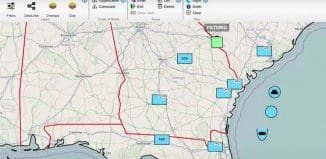
The backbone of the PSIM platform is its Geographic Information System (GIS) engine, which uses precise global coordinates to present layers of diagrams and pictures over a map of the city. Different layers can contain information on the locations of buildings and roads, water and power lines, response force units, sensors, satellite photographs, evacuation routes and more. Using multiple map windows with independent zooming, panning, and layer selection, GIS enables presentation of information in a clear, uncluttered way without sacrificing critical details. For example, a layer showing evacuation routes would remain hidden except during a fire or natural disaster.
The PSIM also uses an innovative event management application that provides control center personnel with predefined response checklists for different emergency and routine events. The checklists, combined with smart video management and archiving, provide detailed records that facilitate investigations and debriefings.
- Control Center
The control center is where information is assembled, processed and displayed.
It is a hub for the analysis and dissemination of information collected from various sources including government agencies, private organizations and individual citizens as well as specialized equipment such as sensors and cameras. The results are faster, more effective responses to service outages, streamlined law enforcement operations and real-time management of crisis situations. In addition, better data collection and analysis leads to more accurate forecasting, policymaking, and long-term allocation of resources.
- Communication Network
Magal S3 has implemented solutions that deliver complete wireless coverage of entire cities. High bandwidth allows for smooth, consistent transmission of video data and the 2.4 MHz network, which remains the property of the municipality, does not interfere with civilian communication systems or the internet. Depending on the requirements of the project, a variety of technologies, including fiber optic networks, bandwidth leased from communications companies (IP VPN) and cellular (mainly for connection to mobile sensors and response personnel) may be used in combination.
The control center is connected directly to response force personnel in the field via mobile computing devices such as tablet PCs and PDAs. Response forces can operate on foot or in patrol cars.
- Sensors
There are many types of sensors, not all of which may be applicable to every solution. It is of paramount importance that the PSIM platform used accept a wide variety of sensor technologies, and also be open to enable the introduction of new technologies as they emerge. The sensors may include cameras, GPS units that relay vehicle positions to the system, Panic Buttons which serve as emergency hotlines for use by the public or response personnel can be placed in various locations. Access Control: used for permitting entrance/exit to authorized persons through doors, gates, lifts etc. Access control may identify individuals via a variety of means including. Another ingredient is the electronic ID Cards which contain data on an individual which must be presented to a card reader for verification. The solution includes Radio Frequency Identification (RFID) badges or tags that will be attached to people or objects to verify their presence in certain defined areas.

Magal S3 stresses that this is a general layout and that each program has to be tailor made to the physical circumstances


