UAV Traffic Management System Will Designate Urban Air Lanes
This post is also available in:  עברית (Hebrew)
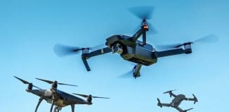
Hundreds of drones are expected to hit the Singapore skies in the near future, but many questions how they will safely fly over dense and urban areas have risen lately. Researchers have unveiled a traffic management system, which is much like the traffic laws and infrastructure cars have on roads.
Named Traffic Management of Unmanned Aircraft Systems, this initiative would designate air-lanes and use virtual fences to reroute drones around restricted geographical locations.
According to the Dailymail.co.uk, the developers are a team from Nanyang Technological University (NTU), Singapore, who have been studying different ways for drones to fly efficiently and safely – even with hundreds in the sky. The initial phase of conceptual design and software simulation is expected to be completed soon.
ATMRI is a joint research Center by NTU and the Civil Aviation Authority of Singapore (CAAS). It aims to research and develop air traffic management solutions for Singapore and the Asia Pacific region, including unmanned aerial vehicle (UAV) traffic management. Leading the research is professor Low Kin Huat, an expert in robotics and UAVs from the School of Mechanical and Aerospace Engineering, and ATMRI Senior Research Fellow, Mohamed Faisal Bin Mohamed Salleh.
Low said: ”At NTU, we have already demonstrated viable technologies such as UAV convoys, formation flying and logistics, which will soon become mainstream. This new traffic management project will test some of the new concepts developed with the aim of achieving safe and efficient drone traffic in our urban airways”.
To ensure that traffic is regulated across the whole of Singapore, a possible solution is an establishment of coordinating stations for UAV traffic.
This will allow the stations to track all of the drones buzzing in the air, schedule the traffic flow, monitor their speeds and ensure a safe separation between the devices.
Faisal, the co-investigator of the program, said the team will test a range of scenarios using computer simulations and software to optimize UAV traffic routes, so as to minimize traffic congestion.
There would be a slow lane for local traffic below 200 feet (60 meters) and a fast lane for long-distance transport between 200 (60 meters) and 400 feet (120 meters). Altitudes between 400 (120 meters) and 500 feet (152 meters) would become a no-fly zone, and anything above that is already against FAA regulations.
In cases when aircraft would enter drone flyways, drones would automatically give way, he said. The vehicles must also be capable of communicating with each other.
A centralized computer system of known flight hazards, such as towers and high ground, would be developed and shared with drone users, allowing them to automatically avoid these areas. Long-range drones must also give notice when and where they intend to fly, and they have to be connected to the internet, he added.


