The unmanned cargo helicopter
This post is also available in:  עברית (Hebrew)
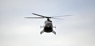
Unmanned cargo helicopters have proved their worth in Afghanistan, resupplying remote forward bases and taking convoys off dangerous roads. But the U.S. Army wants to take the next step, beyond carefully planned missions to autonomous operations, including obstacle avoidance and dynamic route re-planning.
According to Aviation Week advanced capabilities are being developed by Lockheed Martin using an unmanned Kaman K-Max external-lift helicopter as the test bed for the Army Aviation Applied Technology Directorate’s Autonomous Technologies for Unmanned Air Systems (ATUAS) demonstration program. The initial demo, in April 2012, involved a ground beacon that enables loads to be delivered to within 3 meters (10 ft.) of a drop point.
The beacon was deployed to Afghanistan, where two K-Max unmanned helicopters were being used to resupply remote U.S. Marine Corps forward operating bases until operations were suspended in early June after one of the aircraft crashed.
 The crash has not affected the ATUAS program, and in July Lockheed Martin conducted the second series of demonstrations at Fort Pickett, Va. These included passing high-definition video over high-bandwidth satellite communications to provide improved situational awareness for the operator.
“We swapped out the low-resolution EO/IR [electro-optical/infrared sensor] and put on a high-definition EO/IR, but that needed a much higher- bandwidth signal,” says Jon McMillen, business development manager for K-Max. “We wanted to do beyond line-of-sight, and still wanted to use satcom. So we integrated a high-bandwidth, Ku-band satcom dish under the rotors, and created a waveform to pipe the high-def video through the rotors,” he says.
McMillen says real-time video via satcom through the rotors is an “industry first.” To avoid blockage by the rotating blades, the waveform allows the signal “to shoot between rotor cycles, to go between the blades,” he says. Real-time video via satcom allows the remote operator to use a gimbaled EO/IR sensor—a Wescam MX-10 was used for the demo—to get a downward view from the helicopter and look around the drop zone, he says, reducing the need for personnel on site.
The latest demo also includes dynamic mission replanning. “In flight, we uploaded a no-fly zone direct to the air vehicle. The aircraft sensed the obstacle directly ahead, and automatically re-planned around it,” McMillen says. The no-fly zone could represent a threat or airspace to be avoided. Re-planning was performed on the aircraft, with the revised route displayed in the control station to alert the operator and provide the option to intervene.


