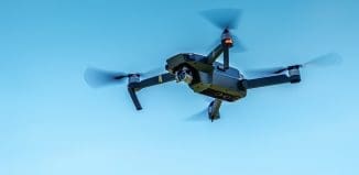
UAS operators finally to receive data other pilots have always had
This post is also available in:  עברית (Hebrew)
“For the first time, UAS operators and test range personnel will have the same situational awareness currently available only to general aviation pilots, says said Ed Sayadian, vice president of Civil and Aerospace Solutions for Exelis.
Exelis has just come out with its first airspace situational awareness tool, designed specifically for unmanned aerial system (UAS) operations in the US. The new Symphony RangeVue puts real-time Federal Aviation Administration (FAA) surveillance data, flexible background maps and weather information in the hands of UAS operators and test range personnel. According to its manufacturers the system provides significant improvements to the safety and efficiency of UAS operations.
Symphony RangeVue enables UAS operators and test range personnel to have access to both real-time and historical surveillance information, via a web-hosted platform. Missions can, in this way, be managed from several different locations simultaneously. The new surveillance tool can be used as a command center to support the decision making process, can be used as a post-event analysis tool, and used in the field as an addition to UAS ground control stations.
The new tool’s geo-fencing apparatus provides the operator with alerts when a UAS approaches airspace boundaries or when other aircraft are in the vicinity. Sayadian explains the advantage here is that no additional avionics surveillance equipment needs to be installed on the UAS itself.
Symphony RangeVue combines a visualization engine with a network of surveillance data, including all of the FAA’s surveillance systems, as well as automatic surveillance-broadcast, en route radar, terminal radar, airport surface detection equipment, airport surface surveillance capability and wide area multilateration (navigation technique based on the measurement of the difference in distance between two stations). It also integrates locally deployed surveillance assets to deliver local situational awareness.


