UAS-gathered images to help first responders
This post is also available in:  עברית (Hebrew)

Aerial imagery of infrastructure will assist first responders in rescue missions and disaster areas.
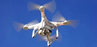
Israeli manufacturers of unmanned air systems (UAS) see a growing demand for their systems by first responder organizations and bodies. “This market is growing steadily and will become big in the next five years,” an industry source told i-HLS.
UAS, fixed wing and rotary systems, including quadcopters, are not enough. They have to be equipped with special software and dedicated payloads.
According to Home Land Security News Wire, Doug Stow, a geography professor from San Diego State University (SDSU), is developing a program that uses before-and-after aerial imagery to reveal infrastructure damage in a matter of minutes.
“After a disaster, emergency responders need to know what’s damaged and what’s functioning,” said Stow, who recently received a $365,000 grant from the National Science Foundation to support this research.
The idea behind the project is as follows: Emergency officials identify ahead of time the critical infrastructure they will need in case of an emergency – power stations, bridges, dams, hospitals, and others – and researchers like Stow send out unmanned aerial vehicles (UAVs) and piloted light sport aircraft (LSA) to take bird’s-eye pictures of the intact buildings and environment.
Register to iHLS Israel Homeland Security
During the flight, the UAVs record their GPS locations and altitude and report back both their positions and the images. This data is then filed into a computer program. If a disaster occurs, emergency managers can immediately send back a UAV to take aerial imagery from the exact same location and altitude, process the before-and-after images to detect changes, and report back with a damage map.
A computer program compares the two images and does a highly advanced version of a “spot-the-differences” game, pointing out to researchers and officials where the images differ. These differences can highlight walls that have crumbled, ceilings that have collapsed, roads that have buckled, and other signs of infrastructure damage.
Several other SDSU researchers, students and graduates are also supporting the project. Electrical engineer Sunil Kumar is helping to determine how to optimize the wireless image and map transfer between ground control and the aircraft.
Israeli companies are now beginning to develop similar software tools that will allow the “eyes in the sky” to give first responders the tools to better function in disasters.


