Drones are taking pictures that could demystify a Malaria surge
This post is also available in:  עברית (Hebrew)

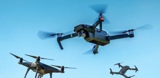
Four hundred feet above a Malaysian forest, a three-foot eBee drone hovers and takes pictures with a 16-megapixel camera every 10 to 20 seconds. The drone is looking at a changing landscape that holds clues to the disease’s spread.
The malaria drone mission began in December 2013, when UK scientists decided to track a rare strain of the mosquito-borne disease that has surged near Southeast Asian cities. Understanding deforestation may be the key in seeing how this kind of malaria, known as Plasmodium knowlesi, is transmitted.
The mosquitoes that carry Plasmodium knowlesi are forest dwellers. The insects breed in cool pools of water under the forest canopy and sap blood from macaque monkeys that harbor the malaria parasite.
Human cases of this kind of malaria didn’t surface in Malaysia until about 10 years ago, says infectious disease specialist Kimberly Fornace of the London School of Hygiene and Tropical Medicine. She is leading the drone study.
While cases of the most common malaria strains have steadily dropped during this time, Plasmodium knowlesi has thrived. It’s now the number-one cause of malaria in the region. Fornace and her team suspect that human intrusion into forested areas has created more opportunities for the disease to pass between primates and humans via mosquitoes.
Unmanned systems conference 2014 – Israel
The drone imagery they’ve collected so far suggests there were occasions where land development forced macaques within closer proximity of humans, who then developed malaria.
As part of a project called MONKEYBAR, the team tracks outbreaks by comparing the drone’s land surveillance with hospital records of malaria cases. Meanwhile, a local wildlife commission has fitted macaques with GPS collars, which let scientists monitor the locations of monkey troops. Together, this information paints a public health map that explains how land development has influenced monkey movements as well as transmission of malaria to humans. In partnership with Conservation Drones, an organization that builds drones for under $1,000, Fornace and her team plan to build a drone that snaps thermal images of macaques, so the monkeys can someday be identified without GPS collars.


