Le Sueur County: first to get FAA approval for drone operations
This post is also available in:  עברית (Hebrew)

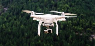
Le Sueur County has contracted Tim Briggs, president of AeroLogix Consulting Inc., to use his Unmanned Aerial Vehicle (UAV) to collect high resolution aerial imagery, Le Sueur County Geographic Information Systems Specialist Justin Lutterman told suasnews.
Briggs came to the county commissioners meeting a year ago this month seeking approval of a proposed contract to provide the county with aerial survey and Geographic Information System imagery of Le Sueur County.
“The idea that I proposed to Le Sueur County is that we could create high-resolution images on demand and it would be compatible with images like Google Earth and programs the county guys use. I would use the UAV instead of a conventionally piloted airplane, so it would be affordable,” Briggs said.
Since Briggs’ first meeting with the county, he worked to get approval from the Federal Aviation Administration for UAV operations under the contract. Approval from the FAA was given in January and final clearance from the FAA was given on August 25.
Unmanned Systems Conference 2014 – Israel
The FAA stipulates Briggs cannot operate within 2 miles of the Le Sueur and Mankato Airports, as well as not over any densely populated area in the county. The UAV can’t fly within 500 feet of any structure.
Each time the UAV is flown, Briggs has to notify the FAA of the very specific airspace it will be flying in.
“I have to advise them of where I’m going to operate each time. I have to log every flight, the duration, where it flew and the altitude. I have to submit a report every month as to where we operated and how many hours. Any mishaps or anything must be reported immediately,” Briggs said.
In addition to ongoing mapping and surveying, in the case of a natural disaster, rapid emergency response is critical, and it can now be better facilitated. “In the case of a flood or tornado or some sort of disaster, if the county wants imagery we could quickly activate the airspace and quickly get imagery. We can go operational in two hours,” Briggs said.


